We are in Engine 4319, which is a SD70 Mack engine built by GE with 4,000 horsepower. It has a top speed of 59 mph, although we will mostly travel at 25 mph.

We sit on the top level of the two level car (18' tall, 10' wide, weighs 90 tons), with glass domes as the top half of the train. Great views of the countryside .


We followed along the Nenana river to the Broad Pass, which is a Major watershed divide and is at 2,700 ft elevation. This means that the Nenana river on the north side of the pass flows to the north, but the Sustitna and the Chulitna (on the southnsidenofnthe divide) flow to the south, eventually flowing to the bay.


We also passed a very interesting neighborhood in southern Anchorage. Check out what is behind everyone's house:
 Just before arriving at the ship, we passed an area that used to be a forest - with the 1964 earthquake, though, it was inundated by salt water, which killed the trees. Very eerie.

And we arrive at the ship. Very cool - the ship is directly across from the end of the train rail. The Island Princess.

And I got to see an Eagle!! There really is an eagle on the top of that tree. Blow it up - he is there. (saw one flying later as well.) We've been told there will be lots more later in the cruise. I can't wait.
Also found out that the leading cause of Bald Eagle deaths are King Salmon. They grab one that is too big (such as 90 lbs big) and can't get airbone. And then the end up drowning, as they cannot get their talons out of the fish.
Also found out that the leading cause of Bald Eagle deaths are King Salmon. They grab one that is too big (such as 90 lbs big) and can't get airbone. And then the end up drowning, as they cannot get their talons out of the fish.

We followed along the Nenana river to the Broad Pass, which is a Major watershed divide and is at 2,700 ft elevation. This means that the Nenana river on the north side of the pass flows to the north, but the Sustitna and the Chulitna (on the southnsidenofnthe divide) flow to the south, eventually flowing to the bay.
South of the divide is Hurricane Gulch. So called for the intense winds that travel thru the gulch - whe the bridge was being built, 3 workers were blown off the bridge. The bridge is 384 feet across and 296 feet above the creek - which is a snow melt creek. This is a crystal clear melting for a Gllacier - but just a small apart of the snow layer -- which is why its not as silty as the glacial river.
The small creed from the bottom of the photo is the snow melt creek, and it is running into the Chulitna river, which is a glacier river. Snow melt rivers are crystal clean - they are created from the top layers of the snow on the glacier melting. Glacier Rivers are Silty (very muddy) and full of rock flour, as they are all the debris of the glacier.

Another train passed us' very slowly
And we passed is Nancy Lake


We also passed a very interesting neighborhood in southern Anchorage. Check out what is behind everyone's house:
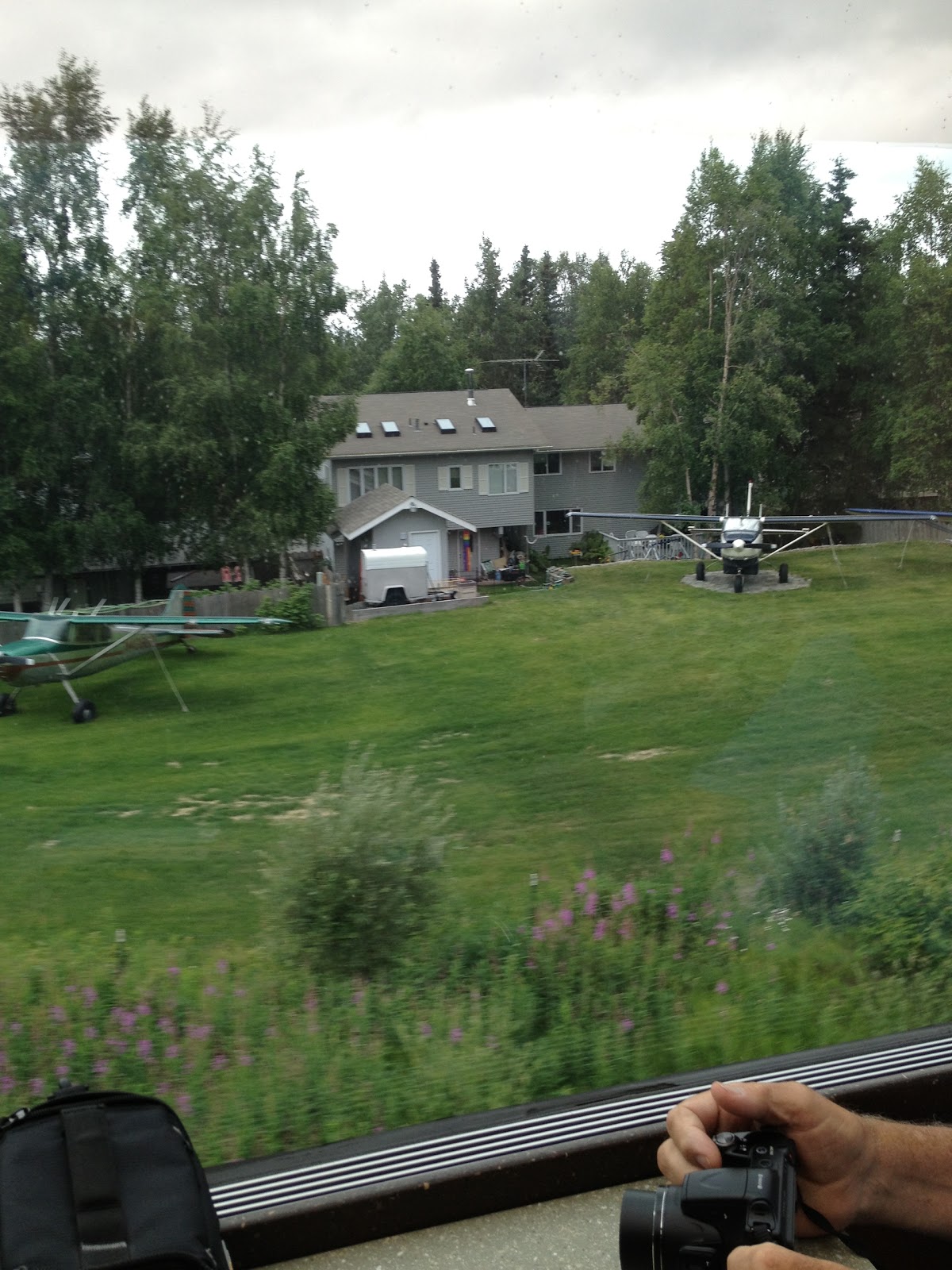 Every house had a hanger at the back, and they were all sharing a grass landing strip. How very, very cool. How very Alaskan!!
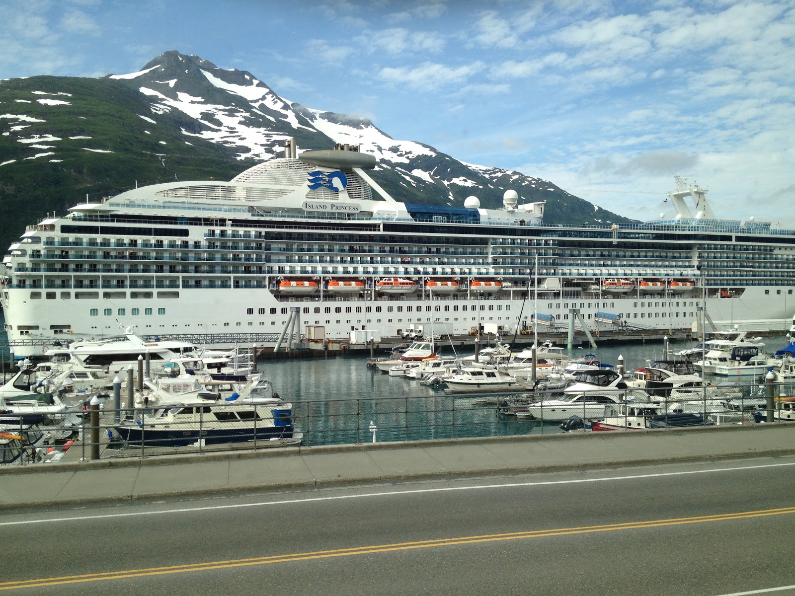
And we arrive at the ship. Very cool - the ship is directly across from the end of the train rail. The Island Princess.
We will be at sea for two days looking at glacier bays - with by limited connectivity,so please be patient. I probably won't be able to update the blog for a few days.
No comments:
Post a Comment